
Magnitude |
:3.1 |
| Date & Time (UTC) | 2026-02-13 23:34:45.1 |
| Date & Time (Local) | 1404/11/25 03:04:45.1 |
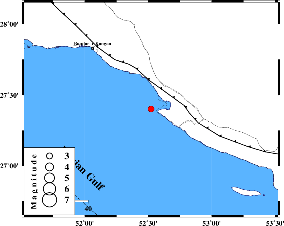
| Location | Lat:27.401 Lon: 52.522 |
| Region | Persian Gulf, 40 km South-West of Mehr |
Nearest Cities |
|
| 12 km of Bandar-e asaluyeh, Bushehr Province | |
| 27 km North West of Chah-e mobarak, Bushehr Province | |
| 32 km South West of Gallehdar, Fars Province | |
| 34 km South East of Bandar-e taheri, Bushehr Province | |
| 35 km South West of Ardavan-e olia, Fars Province | |
| Depth | 12 km |
| Agency | |
Faults within 150 km: |
|
| MFF3 (Length: 292 km) , Distance to epicenter: 23 km | |
| BORAZJAN_F (Length: 168 km) , Distance to epicenter: 113 km | |
| QIR_F (Length: 130 km) , Distance to epicenter: 119 km | |
| Number of Phases | 6 |
| RMS | 0.2 |
| Number of Stations | 6 |
| Error in Latitude | >3 km |
| Error in Longitude | 3 km |
| Error in Depth | 346.9 km |
Download waveform in seisan format
to download seisan software Click here
to access information about IIEES stations Click here
Amplitude | ||||||||
| UID | Agency | Station | Component | Amplitude | Period | Arrival Time | Proccessing Time | Signal Clip |
| 201555 | IIEES SC | GENO | Z | 0.1 | 1 | 2026-02-13 23:35:38 | 2026-02-21 10:03:00 | n |
| 201556 | IIEES SC | UOSS | Z | 0.02 | 1 | 2026-02-13 23:35:49 | 2026-02-21 10:03:00 | n |
| 201557 | IIEES SC | KRVR | Z | 0.02 | 1 | 2026-02-13 23:36:11 | 2026-02-21 10:03:00 | n |
| 201558 | IIEES SC | IRSR | Z | 0.004 | 1 | 2026-02-13 23:36:35 | 2026-02-21 10:03:00 | n |
Phase | ||||||||||||
| Agency | Station | Component | Phase Type | Phase Quality | First Motion | Observed Arrival Time | Time Residual | Loc. Flag | Input Weight | Distance | Azimuth | |
| IIEES SC | GENO | Z | EPn | E | 2026-02-13 23:35:38 | 0.1 | y | 0 | 361 | 90 | ||
| IIEES SC | UOSS | Z | EPn | E | 2026-02-13 23:35:49 | -0.1 | y | 0 | 458 | 126 | ||
| IIEES SC | BRJ | Z | EPn | E | 2026-02-13 23:35:56 | -0.4 | y | 0 | 514 | 346 | ||
| IIEES SC | AMS1 | Z | EPn | E | 2026-02-13 23:36:07 | 0.3 | y | 0 | 598 | 329 | ||
| IIEES SC | KRVR | Z | EPn | E | 2026-02-13 23:36:11 | 0.2 | y | 0 | 631 | 42 | ||
| IIEES SC | IRSR | Z | EPn | E | 2026-02-13 23:36:35 | 0 | y | 0 | 828 | 93 | ||