
Magnitude |
:3.5 |
| Date & Time (UTC) | 2026-02-20 05:30:29.1 |
| Date & Time (Local) | 1404/12/1 09:00:29.1 |
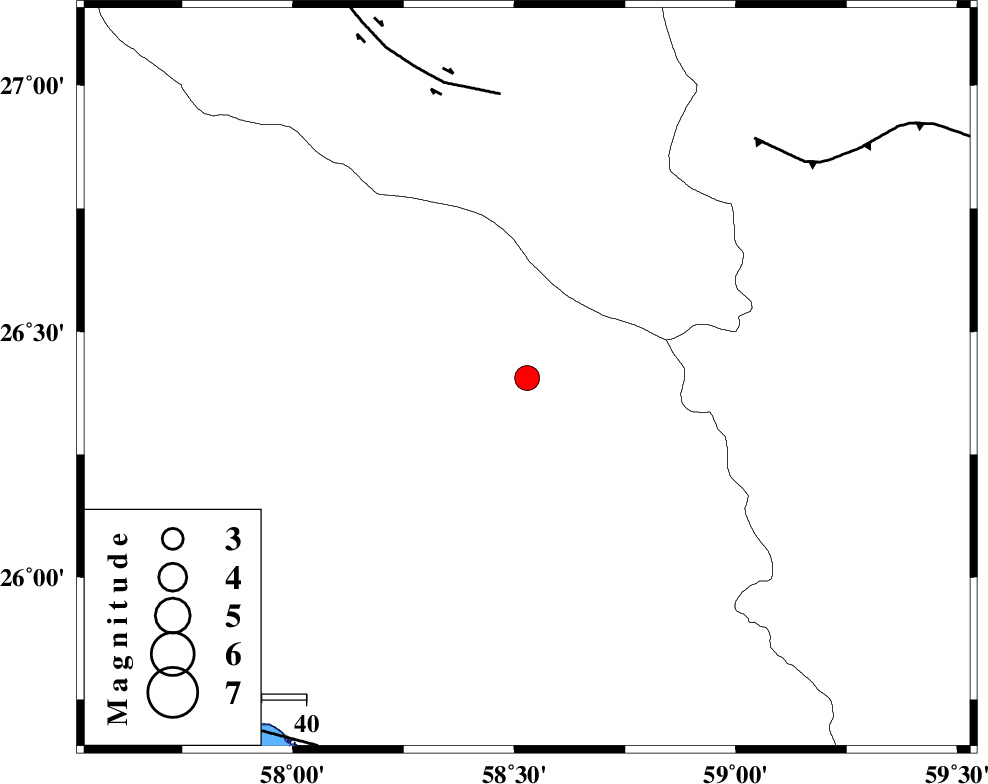
| Location | Lat:26.406 Lon: 58.529 |
| Region | Hormozgan Province, 115 km North-East of Jask |
Nearest Cities |
|
| 54 km South West of Ramashk, Kerman Province | |
| 55 km North West of Tutan, Sistan va Baloochestan Province | |
| 66 km South East of Angahran, Hormozgan Province | |
| 88 km North West of Dastgerd, Sistan va Baloochestan Province | |
| 90 km North East of Yekdar, Hormozgan Province | |
| Depth | 12 km |
| Agency | |
Faults within 150 km: |
|
| JIROFT_F (Length: 144 km) , Distance to epicenter: 64 km | |
| S_JAZMURIAN_F (Length: 91 km) , Distance to epicenter: 74 km | |
| MAKRAN_F (Length: 414 km) , Distance to epicenter: 93 km | |
| Number of Phases | 7 |
| RMS | 0.3 |
| Number of Stations | 7 |
| Error in Latitude | >2.2 km |
| Error in Longitude | 2.2 km |
| Error in Depth | 441.1 km |
Download waveform in seisan format
to download seisan software Click here
to access information about IIEES stations Click here
Amplitude | ||||||||
| UID | Agency | Station | Component | Amplitude | Period | Arrival Time | Proccessing Time | Signal Clip |
| 201518 | IIEES SC | SRVN | Z | 0.1 | 1 | 2026-02-20 05:31:26 | 2026-02-21 07:13:00 | n |
| 201519 | IIEES SC | KRVR | Z | 0.03 | 1 | 2026-02-20 05:31:52 | 2026-02-21 07:13:00 | n |
Phase | ||||||||||||
| Agency | Station | Component | Phase Type | Phase Quality | First Motion | Observed Arrival Time | Time Residual | Loc. Flag | Input Weight | Distance | Azimuth | |
| IIEES SC | GENO | Z | EPn | E | 2026-02-20 05:31:10 | 1 | y | 0 | 259 | 295 | ||
| IIEES SC | UOSS | Z | EPn | E | 2026-02-20 05:31:12 | -0.1 | y | 0 | 284 | 235 | ||
| IIEES SC | SRVN | Z | EPn | E | 2026-02-20 05:31:26 | 0 | y | 0 | 400 | 74 | ||
| IIEES SC | KRVR | Z | EPn | E | 2026-02-20 05:31:52 | 0.2 | y | 0 | 604 | 344 | ||
| IIEES SC | KOO | Z | EPn | E | 2026-02-20 05:32:00 | -0.2 | y | 0 | 669 | 4 | ||
| IIEES SC | BRJ | Z | EPn | E | 2026-02-20 05:32:32 | -0.6 | y | 0 | 934 | 311 | ||
| IIEES SC | AMS1 | Z | EPn | E | 2026-02-20 05:32:52 | 0.1 | y | 0 | 1088 | 305 | ||