
Magnitude |
:3 |
| Date & Time (UTC) | 2026-01-23 08:47:42.0 |
| Date & Time (Local) | 1404/11/3 12:17:42.0 |
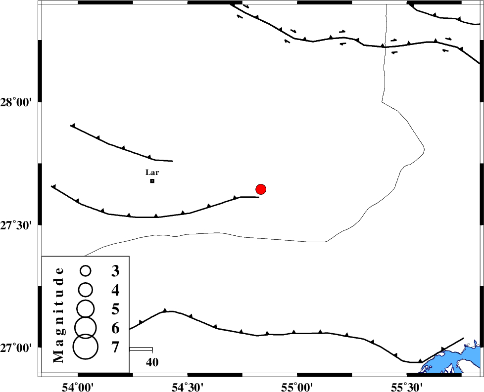
| Location | Lat:27.645 Lon: 54.834 |
| Region | Fars Province, 49 km -East of Lar |
Nearest Cities |
|
| 45 km East of Latifi, Fars Province | |
| 47 km South East of Dehkuyeh, Fars Province | |
| 49 km East of Lar, Fars Province | |
| 63 km South West of Darz, Fars Province | |
| 66 km East of Grash, Fars Province | |
| Depth | 12 km |
| Agency | |
Faults within 150 km: |
|
| LAR_F (Length: 99 km) , Distance to epicenter: 4 km | |
| BERIZ_F (Length: 49 km) , Distance to epicenter: 41 km | |
| MFF1 (Length: 180 km) , Distance to epicenter: 66 km | |
| Number of Phases | 5 |
| RMS | 0.3 |
| Number of Stations | 5 |
| Error in Latitude | >22.6 km |
| Error in Longitude | 22.6 km |
| Error in Depth | 22.5 km |
Download waveform in seisan format
to download seisan software Click here
to access information about IIEES stations Click here
Amplitude | ||||||||
| UID | Agency | Station | Component | Amplitude | Period | Arrival Time | Proccessing Time | Signal Clip |
| 201181 | IIEES SC | GENO | Z | 0.6 | 1 | 2026-01-23 08:48:04 | 2026-01-25 06:26:00 | n |
| 201182 | IIEES SC | GENO | Z | 0.6 | 1 | 2026-01-23 08:48:20 | 2026-01-25 06:26:00 | n |
| 201183 | IIEES SC | IRSR | Z | 0.01 | 1 | 2026-01-23 08:49:05 | 2026-01-25 06:26:00 | n |
Phase | ||||||||||||
| Agency | Station | Component | Phase Type | Phase Quality | First Motion | Observed Arrival Time | Time Residual | Loc. Flag | Input Weight | Distance | Azimuth | |
| IIEES SC | GENO | Z | EPg | E | 2026-01-23 08:48:04 | 0.2 | y | 0 | 135 | 102 | ||
| IIEES SC | GENO | Z | ESg | E | 2026-01-23 08:48:20 | -0.4 | y | 0 | 135 | 102 | ||
| IIEES SC | GHIR | Z | EPg | E | 2026-01-23 08:48:13 | -0.3 | y | 0 | 195 | 291 | ||
| IIEES SC | IRSR | Z | EPn | E | 2026-01-23 08:49:05 | 0.5 | y | 0 | 601 | 97 | ||
| IIEES SC | AMS1 | Z | EPn | E | 2026-01-23 08:49:19 | 0.2 | y | 0 | 719 | 313 | ||