
Magnitude |
:3.2 |
| Date & Time (UTC) | 2025-12-09 14:49:15.5 |
| Date & Time (Local) | 1404/9/18 18:19:15.5 |
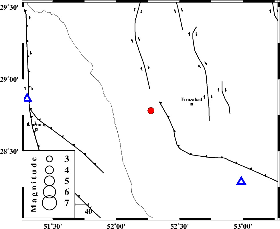
| Location | Lat:28.782 Lon: 52.274 |
| Region | Fars Province, 21 km -East of Farashband |
Nearest Cities |
|
| 21 km East of Farashband, Fars Province | |
| 24 km West of Ahmadabad, Fars Province | |
| 26 km South East of Aviz, Fars Province | |
| 32 km West of Firuz Abad, Fars Province | |
| 33 km North of Dahrom, Fars Province | |
| Depth | 12 km |
| Agency | |
Faults within 150 km: |
|
| QIR_F (Length: 130 km) , Distance to epicenter: 9 km | |
| KAREBASS_F (Length: 98 km) , Distance to epicenter: 17 km | |
| SABZ_PUSHAN_F_Z1 (Length: 69 km) , Distance to epicenter: 45 km | |
| Number of Phases | 5 |
| RMS | 0.4 |
| Number of Stations | 5 |
| Error in Latitude | >189.2 km |
| Error in Longitude | 189.2 km |
| Error in Depth | 790.1 km |
Download waveform in seisan format
to download seisan software Click here
to access information about IIEES stations Click here
Amplitude | ||||||||
| UID | Agency | Station | Component | Amplitude | Period | Arrival Time | Proccessing Time | Signal Clip |
| 200521 | IIEES SC | NASN | Z | 0.02 | 1 | 2025-12-09 14:50:19 | 2025-12-10 07:25:00 | n |
| 200522 | IIEES SC | TABS | Z | 0.01 | 1 | 2025-12-09 14:50:51 | 2025-12-10 07:25:00 | n |
Phase | ||||||||||||
| Agency | Station | Component | Phase Type | Phase Quality | First Motion | Observed Arrival Time | Time Residual | Loc. Flag | Input Weight | Distance | Azimuth | |
| IIEES SC | GHIR | Z | EPg | E | 2025-12-09 14:49:30 | 0.1 | y | 0 | 89 | 128 | ||
| IIEES SC | AHRM | Z | EPg | E | 2025-12-09 14:49:31 | -0.2 | y | 0 | 96 | 276 | ||
| IIEES SC | NASN | Z | EPn | E | 2025-12-09 14:50:19 | 0.5 | y | 0 | 448 | 7 | ||
| IIEES SC | YZKH | Z | EPn | E | 2025-12-09 14:50:20 | -0.4 | y | 0 | 458 | 29 | ||
| IIEES SC | TABS | Z | EPn | E | 2025-12-09 14:50:51 | -0.6 | y | 0 | 710 | 41 | ||