
Magnitude |
:3.1 |
| Date & Time (UTC) | 2025-12-01 05:56:18.4 |
| Date & Time (Local) | 1404/9/10 09:26:18.4 |
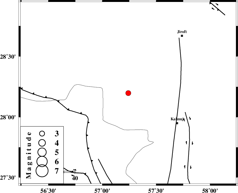
| Location | Lat:28.198 Lon: 57.241 |
| Region | Kerman Province, 52 km North-West of Kahnuj |
Nearest Cities |
|
| 7 km North of Hurpasefid, Kerman Province | |
| 15 km North of Faryab, Kerman Province | |
| 20 km North West of Mehrueye-e paeen, Kerman Province | |
| 30 km West of Bolock, Kerman Province | |
| 39 km South East of Sarkhan, Kerman Province | |
| Depth | 14 km |
| Agency | |
Faults within 150 km: |
|
| MAIN_ZAGROS_R_F (Length: 1106 km) , Distance to epicenter: 43 km | |
| SABZEVARAN_F (Length: 190 km) , Distance to epicenter: 48 km | |
| JIROFT_F (Length: 144 km) , Distance to epicenter: 55 km | |
| Number of Phases | 9 |
| RMS | 0.4 |
| Number of Stations | 9 |
| Error in Latitude | >2.2 km |
| Error in Longitude | 2.2 km |
| Error in Depth | 560.6 km |
Download waveform in seisan format
to download seisan software Click here
to access information about IIEES stations Click here
Amplitude | ||||||||
| UID | Agency | Station | Component | Amplitude | Period | Arrival Time | Proccessing Time | Signal Clip |
| 200406 | IIEES SC | BSRN | Z | 0.03 | 1 | 2025-12-01 05:57:22 | 2025-12-01 08:35:00 | n |
| 200407 | IIEES SC | TABS | Z | 0.02 | 1 | 2025-12-01 05:57:41 | 2025-12-01 08:35:00 | n |
| 200408 | IIEES SC | SHRT | Z | 0.01 | 1 | 2025-12-01 05:57:49 | 2025-12-01 08:35:00 | n |
Phase | ||||||||||||
| Agency | Station | Component | Phase Type | Phase Quality | First Motion | Observed Arrival Time | Time Residual | Loc. Flag | Input Weight | Distance | Azimuth | |
| IIEES SC | UOSS | Z | EPn | E | 2025-12-01 05:57:12 | -0.3 | y | 0 | 375 | 196 | ||
| IIEES SC | ZHSF | Z | EPn | E | 2025-12-01 05:57:13 | -0.1 | y | 0 | 378 | 66 | ||
| IIEES SC | IRSR | Z | EPn | E | 2025-12-01 05:57:14 | 0.8 | y | 0 | 382 | 111 | ||
| IIEES SC | GHIR | Z | EPn | E | 2025-12-01 05:57:18 | 0.5 | y | 0 | 418 | 271 | ||
| IIEES SC | BSRN | Z | EPn | E | 2025-12-01 05:57:22 | -0.6 | y | 0 | 455 | 24 | ||
| IIEES SC | YZKH | Z | EPn | E | 2025-12-01 05:57:31 | -0.5 | y | 0 | 530 | 331 | ||
| IIEES SC | TABS | Z | EPn | E | 2025-12-01 05:57:41 | 0.3 | y | 0 | 604 | 359 | ||
| IIEES SC | SHRT | Z | EPn | E | 2025-12-01 05:57:49 | 0.3 | y | 0 | 671 | 26 | ||
| IIEES SC | CHTH | Z | EPn | E | 2025-12-01 05:58:34 | -0.1 | y | 0 | 1032 | 326 | ||