
Magnitude |
:3.3 |
| Date & Time (UTC) | 2025-09-10 19:53:53.1 |
| Date & Time (Local) | 1404/6/19 23:23:53.1 |
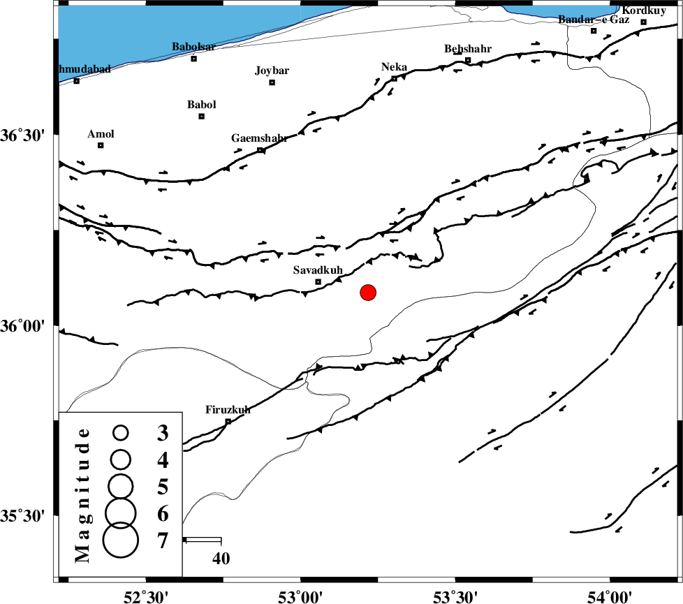
| Location | Lat:36.086 Lon: 53.218 |
| Region | Mazandaran Province, 15 km -East of Pol-E-Sefid |
Nearest Cities |
|
| 2 km North of Sangdeh, Mazandaran Province | |
| 15 km East of Pol-E-Sefid, Mazandaran Province | |
| 15 km East of Shurmast-e peyrudbar, Mazandaran Province | |
| 22 km East of Elahband, Mazandaran Province | |
| 22 km North of Chashem, Semnan Province | |
| Depth | 12 km |
| Agency | |
Faults within 150 km: |
|
| N_ALBORZ_F (Length: 360 km) , Distance to epicenter: 14 km | |
| ATARI_F (Length: 185 km) , Distance to epicenter: 44 km | |
| KHAZAR_F (Length: 523 km) , Distance to epicenter: 49 km | |
| Number of Phases | 8 |
| RMS | 0.2 |
| Number of Stations | 8 |
| Error in Latitude | >2.7 km |
| Error in Longitude | 2.7 km |
| Error in Depth | 7.4 km |
Download waveform in seisan format
to download seisan software Click here
to access information about IIEES stations Click here
Amplitude | ||||||||
| UID | Agency | Station | Component | Amplitude | Period | Arrival Time | Proccessing Time | Signal Clip |
| 199072 | IIEES SC | NASN | Z | 0.1 | 1 | 2025-09-10 19:54:46 | 2025-09-13 08:20:00 | n |
| 199073 | IIEES SC | TABS | Z | 0.04 | 1 | 2025-09-10 19:54:56 | 2025-09-13 08:20:00 | n |
| 199074 | IIEES SC | KAGH | Z | 0.006 | 1 | 2025-09-10 19:55:17 | 2025-09-13 08:20:00 | n |
| 199075 | IIEES SC | SHRT | Z | 0.02 | 1 | 2025-09-10 19:55:28 | 2025-09-13 08:20:00 | n |
Phase | ||||||||||||
| Agency | Station | Component | Phase Type | Phase Quality | First Motion | Observed Arrival Time | Time Residual | Loc. Flag | Input Weight | Distance | Azimuth | |
| IIEES SC | DAMV | Z | EPg | E | 2025-09-10 19:54:09 | -4.3 | n | 4 | 123 | 246 | ||
| IIEES SC | ABGH | Z | EPg | E | 2025-09-10 19:54:19 | -0.3 | y | 0 | 159 | 63 | ||
| IIEES SC | SHRO | Z | EPn | E | 2025-09-10 19:54:29 | -3.2 | n | 4 | 252 | 92 | ||
| IIEES SC | NASN | Z | EPn | E | 2025-09-10 19:54:46 | 0 | y | 0 | 367 | 186 | ||
| IIEES SC | TABS | Z | EPn | E | 2025-09-10 19:54:56 | -0.1 | y | 0 | 448 | 127 | ||
| IIEES SC | KAGH | Z | EPn | E | 2025-09-10 19:55:17 | 0.3 | y | 0 | 611 | 81 | ||
| IIEES SC | SHRT | Z | EPn | E | 2025-09-10 19:55:28 | 0.2 | y | 0 | 701 | 113 | ||
| IIEES SC | BSRN | Z | EPn | E | 2025-09-10 19:55:16 | -13.4 | n | 4 | 712 | 130 | ||