
Magnitude |
:3.3 |
| Date & Time (UTC) | 2025-09-10 19:37:31.4 |
| Date & Time (Local) | 1404/6/19 23:07:31.4 |
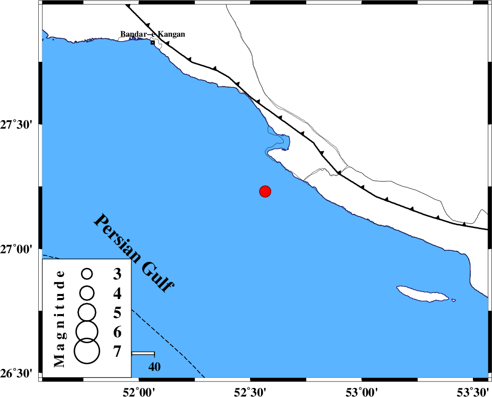
| Location | Lat:27.23 Lon: 52.566 |
| Region | Persian Gulf, 47 km South-West of Mehr |
Nearest Cities |
|
| 26 km South West of Chah-e mobarak, Bushehr Province | |
| 27 km South of Bandar-e asaluyeh, Bushehr Province | |
| 46 km South West of Ardavan-e olia, Fars Province | |
| 47 km South West of Khoozi, Fars Province | |
| 47 km South West of Mehr, Fars Province | |
| Depth | 12 km |
| Agency | |
Faults within 150 km: |
|
| MFF3 (Length: 292 km) , Distance to epicenter: 30 km | |
| BORAZJAN_F (Length: 168 km) , Distance to epicenter: 127 km | |
| ZFF1 (Length: 165 km) , Distance to epicenter: 130 km | |
| Number of Phases | 7 |
| RMS | 0.4 |
| Number of Stations | 7 |
| Error in Latitude | >2.8 km |
| Error in Longitude | 2.8 km |
| Error in Depth | 16.2 km |
Download waveform in seisan format
to download seisan software Click here
to access information about IIEES stations Click here
Amplitude | ||||||||
| UID | Agency | Station | Component | Amplitude | Period | Arrival Time | Proccessing Time | Signal Clip |
| 199068 | IIEES SC | KRBR | Z | 0.05 | 1 | 2025-09-10 19:38:42 | 2025-09-13 08:06:00 | n |
| 199069 | IIEES SC | NASN | Z | 0.01 | 1 | 2025-09-10 19:38:55 | 2025-09-13 08:06:00 | n |
| 199070 | IIEES SC | IRSR | Z | 0.005 | 1 | 2025-09-10 19:39:22 | 2025-09-13 08:06:00 | n |
| 199071 | IIEES SC | TABS | Z | 0.008 | 1 | 2025-09-10 19:39:23 | 2025-09-13 08:06:00 | n |
Phase | ||||||||||||
| Agency | Station | Component | Phase Type | Phase Quality | First Motion | Observed Arrival Time | Time Residual | Loc. Flag | Input Weight | Distance | Azimuth | |
| IIEES SC | GHIR | Z | EPg | E | 2025-09-10 19:37:52 | 0.4 | y | 0 | 124 | 20 | ||
| IIEES SC | UOSS | Z | EPn | E | 2025-09-10 19:38:34 | -0.2 | y | 0 | 443 | 125 | ||
| IIEES SC | KRBR | Z | EPn | E | 2025-09-10 19:38:42 | -0.8 | y | 0 | 511 | 53 | ||
| IIEES SC | NASN | Z | EPn | E | 2025-09-10 19:38:55 | -0.6 | y | 0 | 618 | 2 | ||
| IIEES SC | RAYN | Z | EPn | E | 2025-09-10 19:39:21 | 0.2 | y | 0 | 821 | 240 | ||
| IIEES SC | IRSR | Z | EPn | E | 2025-09-10 19:39:22 | 0.6 | y | 0 | 823 | 92 | ||
| IIEES SC | TABS | Z | EPn | E | 2025-09-10 19:39:23 | 0.7 | y | 0 | 835 | 32 | ||