
Magnitude |
:2.8 |
| Date & Time (UTC) | 2025-05-11 19:38:27.8 |
| Date & Time (Local) | 1404/2/21 23:08:27.8 |
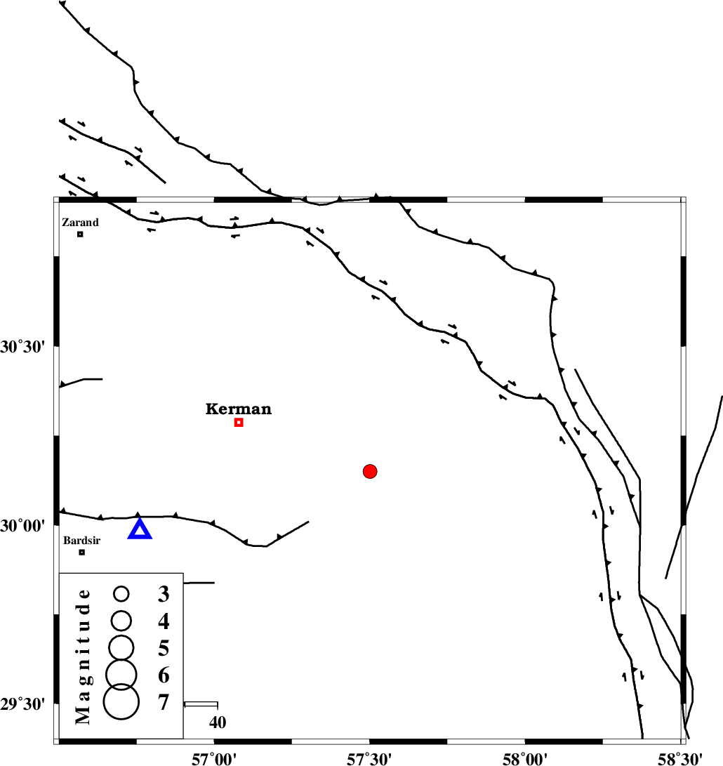
| Location | Lat:30.15 Lon: 57.501 |
| Region | Kerman Province, 43 km South-East of Kerman |
Nearest Cities |
|
| 8 km of Sirch, Kerman Province | |
| 12 km North West of Jushan, Kerman Province | |
| 23 km North East of Mahan, Kerman Province | |
| 23 km North East of Langar, Kerman Province | |
| 27 km North East of Mohiabad, Kerman Province | |
| Depth | 12 km |
| Agency | |
Faults within 150 km: |
|
| GOWK_F (Length: 152 km) , Distance to epicenter: 9 km | |
| GOLBAF_SIRCH_F (Length: 114 km) , Distance to epicenter: 10 km | |
| NAYBAND_F (Length: 258 km) , Distance to epicenter: 31 km | |
| Number of Phases | 6 |
| RMS | 0.6 |
| Number of Stations | 6 |
| Error in Latitude | >30.2 km |
| Error in Longitude | 57.5 km |
| Error in Depth | 12 km |
Download waveform in seisan format
to download seisan software Click here
to access information about IIEES stations Click here
Amplitude | ||||||||
| UID | Agency | Station | Component | Amplitude | Period | Arrival Time | Proccessing Time | Signal Clip |
| 198179 | IIEES SC | ZHSF | Z | 0.05 | 1 | 2025-05-11 19:39:16 | 2025-05-12 04:38:00 | n |
| 198180 | IIEES SC | TABS | Z | 0.03 | 1 | 2025-05-11 19:39:24 | 2025-05-12 04:38:00 | n |
| 198181 | IIEES SC | SHRT | Z | 0.01 | 1 | 2025-05-11 19:39:33 | 2025-05-12 04:38:00 | n |
Phase | ||||||||||||
| Agency | Station | Component | Phase Type | Phase Quality | First Motion | Observed Arrival Time | Time Residual | Loc. Flag | Input Weight | Distance | Azimuth | |
| IIEES SC | KRBR | Z | EPg | E | 2025-05-11 19:38:40 | -0.5 | y | 0 | 74 | 255 | ||
| IIEES SC | BSRN | Z | EPn | E | 2025-05-11 19:38:53 | -14.3 | n | 4 | 254 | 38 | ||
| IIEES SC | ZHSF | Z | EPn | E | 2025-05-11 19:39:16 | 0.5 | y | 0 | 321 | 101 | ||
| IIEES SC | YZKH | Z | EPn | E | 2025-05-11 19:39:06 | -15.6 | n | 4 | 372 | 312 | ||
| IIEES SC | TABS | Z | EPn | E | 2025-05-11 19:39:24 | 0.7 | y | 0 | 390 | 355 | ||
| IIEES SC | SHRT | Z | EPn | E | 2025-05-11 19:39:33 | -0.7 | y | 0 | 469 | 34 | ||