
Magnitude |
:3.4 |
| Date & Time (UTC) | 2025-04-03 01:23:20.8 |
| Date & Time (Local) | 1404/1/14 04:53:20.8 |
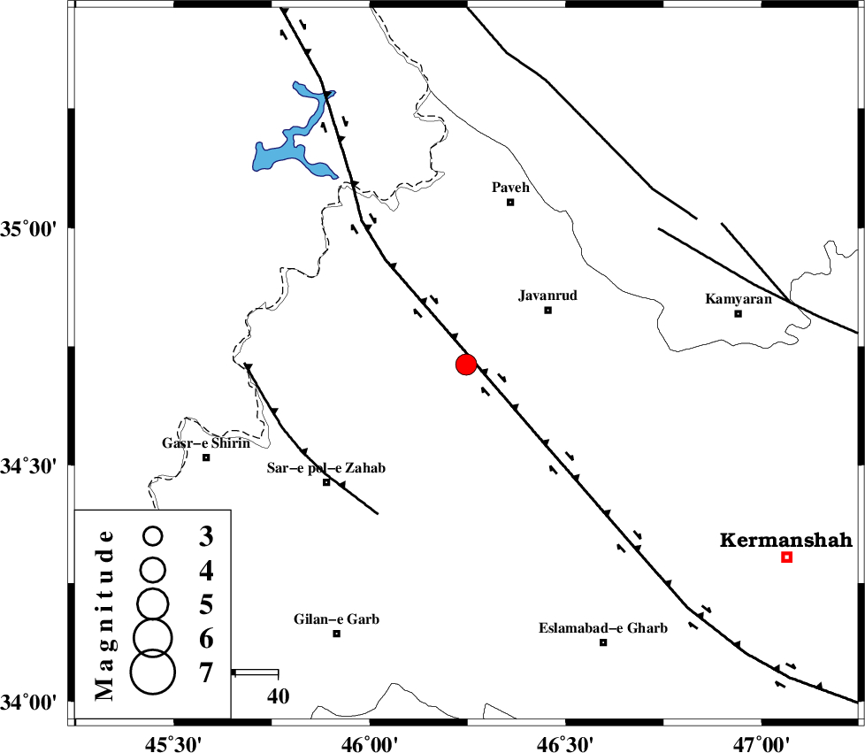
| Location | Lat:34.712 Lon: 46.246 |
| Region | Kermanshah Province, 23 km South-West of Javanrud |
Nearest Cities |
|
| 6 km North of Mirabad, Kermanshah Province | |
| 8 km of Qolqoleh, Kermanshah Province | |
| 15 km South of Shervineh, Kermanshah Province | |
| 19 km West of Sarukhan, Kermanshah Province | |
| 21 km North West of Dolatabad, Kermanshah Province | |
| Depth | 12 km |
| Agency | |
Faults within 150 km: |
|
| HZF4 (Length: 492 km) , Distance to epicenter: 5 km | |
| MFF8 (Length: 48 km) , Distance to epicenter: 41 km | |
| SARTAKHT_F (Length: 78 km) , Distance to epicenter: 55 km | |
| Number of Phases | 6 |
| RMS | 0.3 |
| Number of Stations | 6 |
| Error in Latitude | >2.8 km |
| Error in Longitude | 2.8 km |
| Error in Depth | 17.3 km |
Download waveform in seisan format
to download seisan software Click here
to access information about IIEES stations Click here
Amplitude | ||||||||
| UID | Agency | Station | Component | Amplitude | Period | Arrival Time | Proccessing Time | Signal Clip |
| 197775 | IIEES SC | SRSL | Z | 1 | 1 | 2025-04-03 01:23:50 | 2025-04-08 11:45:00 | n |
| 197776 | IIEES SC | ASAO | Z | 0.1 | 1 | 2025-04-03 01:24:12 | 2025-04-08 11:45:00 | n |
| 197777 | IIEES SC | GHVR | Z | 0.07 | 1 | 2025-04-03 01:24:25 | 2025-04-08 11:45:00 | n |
| 197778 | IIEES SC | CHTH | Z | 0.03 | 1 | 2025-04-03 01:24:25 | 2025-04-08 11:45:00 | n |
| 197779 | IIEES SC | GURO | Z | 0.05 | 1 | 2025-04-03 01:24:39 | 2025-04-08 11:45:00 | n |
Phase | ||||||||||||
| Agency | Station | Component | Phase Type | Phase Quality | First Motion | Observed Arrival Time | Time Residual | Loc. Flag | Input Weight | Distance | Azimuth | |
| IIEES SC | SRSL | Z | EPg | E | 2025-04-03 01:23:50 | 0 | y | 0 | 182 | 336 | ||
| IIEES SC | KAR2 | Z | EPn | E | 2025-04-03 01:24:08 | -0.1 | y | 0 | 317 | 221 | ||
| IIEES SC | ASAO | Z | EPn | E | 2025-04-03 01:24:12 | 0.8 | y | 0 | 347 | 93 | ||
| IIEES SC | GHVR | Z | EPn | E | 2025-04-03 01:24:25 | 0 | y | 0 | 459 | 93 | ||
| IIEES SC | CHTH | Z | EPn | E | 2025-04-03 01:24:25 | -0.6 | y | 0 | 463 | 73 | ||
| IIEES SC | GURO | Z | EPn | E | 2025-04-03 01:24:39 | 0.1 | y | 0 | 569 | 319 | ||