
Magnitude |
:3.2 |
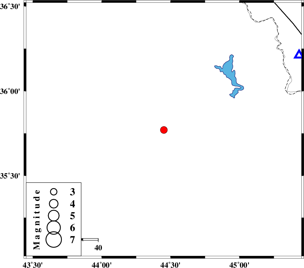
| Date & Time (UTC) | 2021-10-05 11:36:02.1 |
| Date & Time (Local) | 1400/7/13 15:06:02.1 |
| Location | Lat:35.771 Lon: 44.451 |
| Region | Iraq, 92 km North-West of Sulaymaniyah |
Nearest Cities |
|
| 92 km North West of Sulaymaniyah, Iraq Province | |
| 95 km South West of Bivaran-e sofla, Azarbaijan Gharbi Province | |
| 101 km South West of Sardasht, Azarbaijan Gharbi Province | |
| 107 km South West of Bersiv, Azarbaijan Gharbi Province | |
| 107 km South West of Felas, Azarbaijan Gharbi Province | |
| Depth | 12 km |
| Agency | |
Faults within 150 km: |
|
| PIRANSHAHR_F (Length: 253 km) , Distance to epicenter: 107 km | |
| HZF4 (Length: 492 km) , Distance to epicenter: 111 km | |
| Number of Phases | 9 |
| RMS | 0.5 |
| Number of Stations | 9 |
| Error in Latitude | >9.6 km |
| Error in Longitude | 9.6 km |
| Error in Depth | 29.2 km |
Download waveform in seisan format
to download seisan software Click here
to access information about IIEES stations Click here
Amplitude | ||||||||
| UID | Agency | Station | Component | Amplitude | Period | Arrival Time | Proccessing Time | Signal Clip |
| 165735 | IIEES SC | SRSL | Z | 1 | 1 | 2021-10-05 11:36:19 | 2021-10-11 06:53:00 | n |
| 165736 | IIEES SC | MAHB | Z | 1 | 1 | 2021-10-05 11:36:28 | 2021-10-11 06:53:00 | n |
| 165737 | IIEES SC | SNGE | Z | 0.2 | 1 | 2021-10-05 11:36:44 | 2021-10-11 06:53:00 | n |
| 165738 | IIEES SC | KHMZ | Z | 0.03 | 1 | 2021-10-05 11:37:18 | 2021-10-11 06:53:00 | n |
Phase | ||||||||||||
| Agency | Station | Component | Phase Type | Phase Quality | First Motion | Observed Arrival Time | Time Residual | Loc. Flag | Input Weight | Distance | Azimuth | |
| IIEES SC | SRSL | Z | EPg | E | 2021-10-05 11:36:19 | 0.1 | y | 0 | 101 | 61 | ||
| IIEES SC | MAHB | Z | EPg | E | 2021-10-05 11:36:28 | -0.2 | y | 0 | 158 | 46 | ||
| IIEES SC | SNGE | Z | EPn | E | 2021-10-05 11:36:44 | 0.5 | y | 0 | 274 | 106 | ||
| IIEES SC | ILBA | Z | EPn | E | 2021-10-05 11:36:46 | 0.9 | y | 0 | 288 | 146 | ||
| IIEES SC | ZNJK | Z | EPn | E | 2021-10-05 11:36:56 | -2.8 | n | 4 | 394 | 75 | ||
| IIEES SC | MAKU | Z | EPn | E | 2021-10-05 11:36:59 | -0.1 | y | 0 | 398 | 3 | ||
| IIEES SC | GRMI | Z | EPn | E | 2021-10-05 11:36:50 | -16.6 | n | 4 | 455 | 42 | ||
| IIEES SC | KHMZ | Z | EPn | E | 2021-10-05 11:37:18 | -0.7 | y | 0 | 553 | 114 | ||
| IIEES SC | GTMR | Z | EPn | E | 2021-10-05 11:37:19 | -0.6 | y | 0 | 565 | 130 | ||