
Magnitude |
:3.5 |
| Date & Time (UTC) | 2021-09-14 09:33:21.3 |
| Date & Time (Local) | 1400/6/23 14:03:21.3 |
| Location | Lat:34.54 Lon: 45.684 |
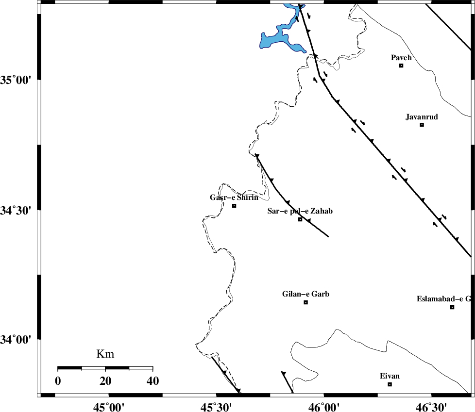
| Region | Kermanshah Province, 10 km -East of Qasr-E-Shirin |
Nearest Cities |
|
| 2 km of Aqabarar, Kermanshah Province | |
| 8 km of Mirmiru, Kermanshah Province | |
| 10 km North East of Qasr-E-Shirin, Kermanshah Province | |
| 11 km North of Qareh belagh, Kermanshah Province | |
| 13 km North of Seyyed sohrab, Kermanshah Province | |
| Depth | 12 km |
| Agency | |
Faults within 150 km: |
|
| MFF8 (Length: 48 km) , Distance to epicenter: 10 km | |
| HZF4 (Length: 492 km) , Distance to epicenter: 54 km | |
| ZFF4 (Length: 128 km) , Distance to epicenter: 70 km | |
| Number of Phases | 10 |
| RMS | 0.2 |
| Number of Stations | 10 |
| Error in Latitude | >1.6 km |
| Error in Longitude | 1.6 km |
| Error in Depth | 2.9 km |
Download waveform in seisan format
to download seisan software Click here
to access information about IIEES stations Click here
Amplitude | ||||||||
| UID | Agency | Station | Component | Amplitude | Period | Arrival Time | Proccessing Time | Signal Clip |
| 165228 | IIEES SC | SRSL | Z | 1 | 1 | 2021-09-14 09:33:51 | 2021-09-15 04:55:00 | n |
| 165229 | IIEES SC | SRSL | Z | 1 | 1 | 2021-09-14 09:34:14 | 2021-09-15 04:55:00 | n |
| 165230 | IIEES SC | GTMR | Z | 0.09 | 1 | 2021-09-14 09:34:17 | 2021-09-15 04:55:00 | n |
| 165231 | IIEES SC | MRD | Z | 0.07 | 1 | 2021-09-14 09:34:26 | 2021-09-15 04:55:00 | n |
Phase | ||||||||||||
| Agency | Station | Component | Phase Type | Phase Quality | First Motion | Observed Arrival Time | Time Residual | Loc. Flag | Input Weight | Distance | Azimuth | |
| IIEES SC | ILBA | Z | EPg | E | 2021-09-14 09:33:40 | 0.1 | y | 0 | 112 | 155 | ||
| IIEES SC | SNGE | Z | EPg | E | 2021-09-14 09:33:48 | 0 | y | 0 | 164 | 68 | ||
| IIEES SC | SRSL | Z | EPg | E | 2021-09-14 09:33:51 | 0 | y | 0 | 187 | 353 | ||
| IIEES SC | SRSL | Z | ESg | E | 2021-09-14 09:34:14 | 0.7 | y | 0 | 187 | 353 | ||
| IIEES SC | MAHB | Z | EPn | E | 2021-09-14 09:34:00 | 0 | y | 0 | 247 | 0 | ||
| IIEES SC | MAHB | Z | ES | E | 2021-09-14 09:34:28 | 0 | y | 0 | 247 | 0 | ||
| IIEES SC | ZNJK | Z | EPn | E | 2021-09-14 09:34:14 | 0.2 | y | 0 | 360 | 49 | ||
| IIEES SC | QABG | Z | EPn | E | 2021-09-14 09:34:16 | 0.2 | y | 0 | 378 | 70 | ||
| IIEES SC | GTMR | Z | EPn | E | 2021-09-14 09:34:17 | -0.2 | y | 0 | 393 | 126 | ||
| IIEES SC | MRD | Z | EPn | E | 2021-09-14 09:34:26 | -0.6 | y | 0 | 463 | 0 | ||