
Magnitude |
:2.8 |
| Date & Time (UTC) | 2019-12-02 03:07:41.6 |
| Date & Time (Local) | 1398/9/11 06:37:41.6 |
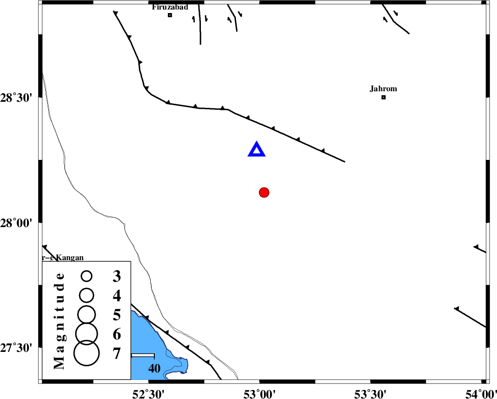
| Location | Lat:28.12 Lon: 53.02 |
| Region | Fars Province, 38 km South of Qir va Karzin |
Nearest Cities |
|
| 13 km West of Seyfabad, Fars Province | |
| 31 km North East of Garmesht, Fars Province | |
| 33 km South of Shahrak-e jonubi, Fars Province | |
| 38 km South of Qir va Karzin, Fars Province | |
| 40 km South West of Mobarakabad, Fars Province | |
| Depth | 20 km |
| Agency | |
Faults within 150 km: |
|
| QIR_F (Length: 130 km) , Distance to epicenter: 29 km | |
| SABZ_PUSHAN_F_Z1 (Length: 69 km) , Distance to epicenter: 71 km | |
| SABZ_PUSHAN_F_Z2 (Length: 24 km) , Distance to epicenter: 72 km | |
| Number of Phases | 4 |
| RMS | 0.1 |
| Number of Stations | 4 |
| Error in Latitude | >0 km |
| Error in Longitude | 0 km |
| Error in Depth | 0 km |
Download waveform in seisan format
to download seisan software Click here
to access information about IIEES stations Click here
Amplitude | ||||||||
| UID | Agency | Station | Component | Amplitude | Period | Arrival Time | Proccessing Time | Signal Clip |
| 149192 | IIEES SC | GHIR | Z | 150 | 1 | 2019-12-02 03:07:56 | 2019-12-02 11:26:00 | n |
| 149193 | IIEES SC | LMD1 | Z | 320 | 1 | 2019-12-02 03:08:11 | 2019-12-02 11:26:00 | n |
| 149194 | IIEES SC | KLNJ | Z | 13 | 1 | 2019-12-02 03:09:43 | 2019-12-02 11:26:00 | n |
Phase | ||||||||||||
| Agency | Station | Component | Phase Type | Phase Quality | First Motion | Observed Arrival Time | Time Residual | Loc. Flag | Input Weight | Distance | Azimuth | |
| IIEES SC | GHIR | N | IS | I | 2019-12-02 03:07:49 | -0.2 | y | 22 | 350 | |||
| IIEES SC | GHIR | Z | IP | I | 2019-12-02 03:07:46 | 0.2 | y | 22 | 350 | |||
| IIEES SC | LMD1 | Z | IP | I | 2019-12-02 03:07:56 | 0 | y | 88 | 171 | |||
| IIEES SC | KLNJ | Z | IP | I | 2019-12-02 03:08:32 | 0 | y | 344 | 337 | |||