
Magnitude |
:2.8 |
| Date & Time (UTC) | 2019-09-29 02:16:57.1 |
| Date & Time (Local) | 1398/7/7 05:46:57.1 |
| Location | Lat:32.07 Lon: 55.74 |
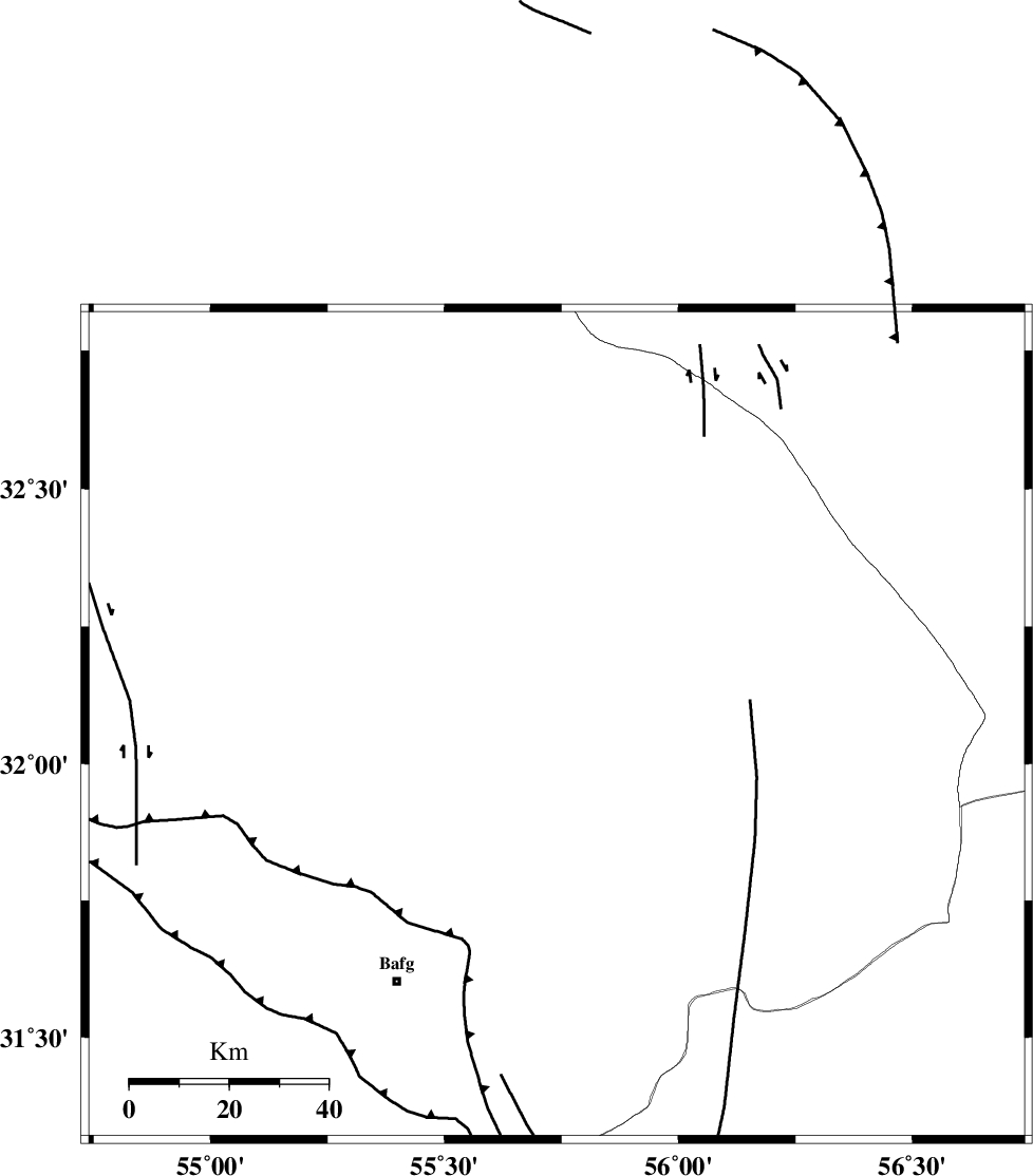
| Region | Yazd Province, 61 km North-East of Bafq |
Nearest Cities |
|
| 35 km North West of Behabad, Yazd Province | |
| 37 km North of Kushk, Yazd Province | |
| 49 km North West of Benestan, Yazd Province | |
| 57 km North East of Mobarake, Yazd Province | |
| 61 km North East of Bafq, Yazd Province | |
| Depth | 10 km |
| Agency | |
Faults within 150 km: |
|
| SARBALA_F (Length: 92 km) , Distance to epicenter: 11 km | |
| KUHBANAN_F (Length: 189 km) , Distance to epicenter: 13 km | |
| JAFARABAD_F (Length: 60 km) , Distance to epicenter: 24 km | |
| Number of Phases | 6 |
| RMS | 1.1 |
| Number of Stations | 6 |
| Error in Latitude | >8 km |
| Error in Longitude | 0 km |
| Error in Depth | 60 km |
Download waveform in seisan format
to download seisan software Click here
to access information about IIEES stations Click here
Amplitude | ||||||||
| UID | Agency | Station | Component | Amplitude | Period | Arrival Time | Proccessing Time | Signal Clip |
| 145937 | IIEES SC | YZKH | Z | 94 | 1 | 2019-09-29 02:17:32 | 2019-09-29 08:50:00 | n |
| 145938 | IIEES SC | TABS | Z | 90 | 1 | 2019-09-29 02:17:39 | 2019-09-29 08:50:00 | n |
| 145939 | IIEES SC | KRBR | Z | 75 | 1 | 2019-09-29 02:18:14 | 2019-09-29 08:50:00 | n |
| 145940 | IIEES SC | NASN | Z | 47 | 1 | 2019-09-29 02:18:18 | 2019-09-29 08:50:00 | n |
| 145941 | IIEES SC | BSRN | Z | 47 | 1 | 2019-09-29 02:18:13 | 2019-09-29 08:50:00 | n |
Phase | ||||||||||||
| Agency | Station | Component | Phase Type | Phase Quality | First Motion | Observed Arrival Time | Time Residual | Loc. Flag | Input Weight | Distance | Azimuth | |
| IIEES SC | YZKH | N | IS | I | 2019-09-29 02:17:30 | -1.3 | y | 111 | 288 | |||
| IIEES SC | YZKH | Z | IP | I | 2019-09-29 02:17:16 | 0 | y | 111 | 288 | |||
| IIEES SC | TABS | Z | IP | I | 2019-09-29 02:17:33 | 0.9 | y | 222 | 36 | |||
| IIEES SC | KRBR | N | IP | I | 2019-09-29 02:17:37 | 0.5 | y | 255 | 157 | |||
| IIEES SC | NASN | Z | IP | I | 2019-09-29 02:17:42 | 1.3 | y | 289 | 286 | |||
| IIEES SC | BSRN | Z | IP | I | 2019-09-29 02:17:43 | -1.7 | y | 322 | 92 | |||