
Magnitude |
:3.1 |
| Date & Time (UTC) | 2017-02-24 00:37:36.7 |
| Date & Time (Local) | 1395/12/6 04:07:36.7 |
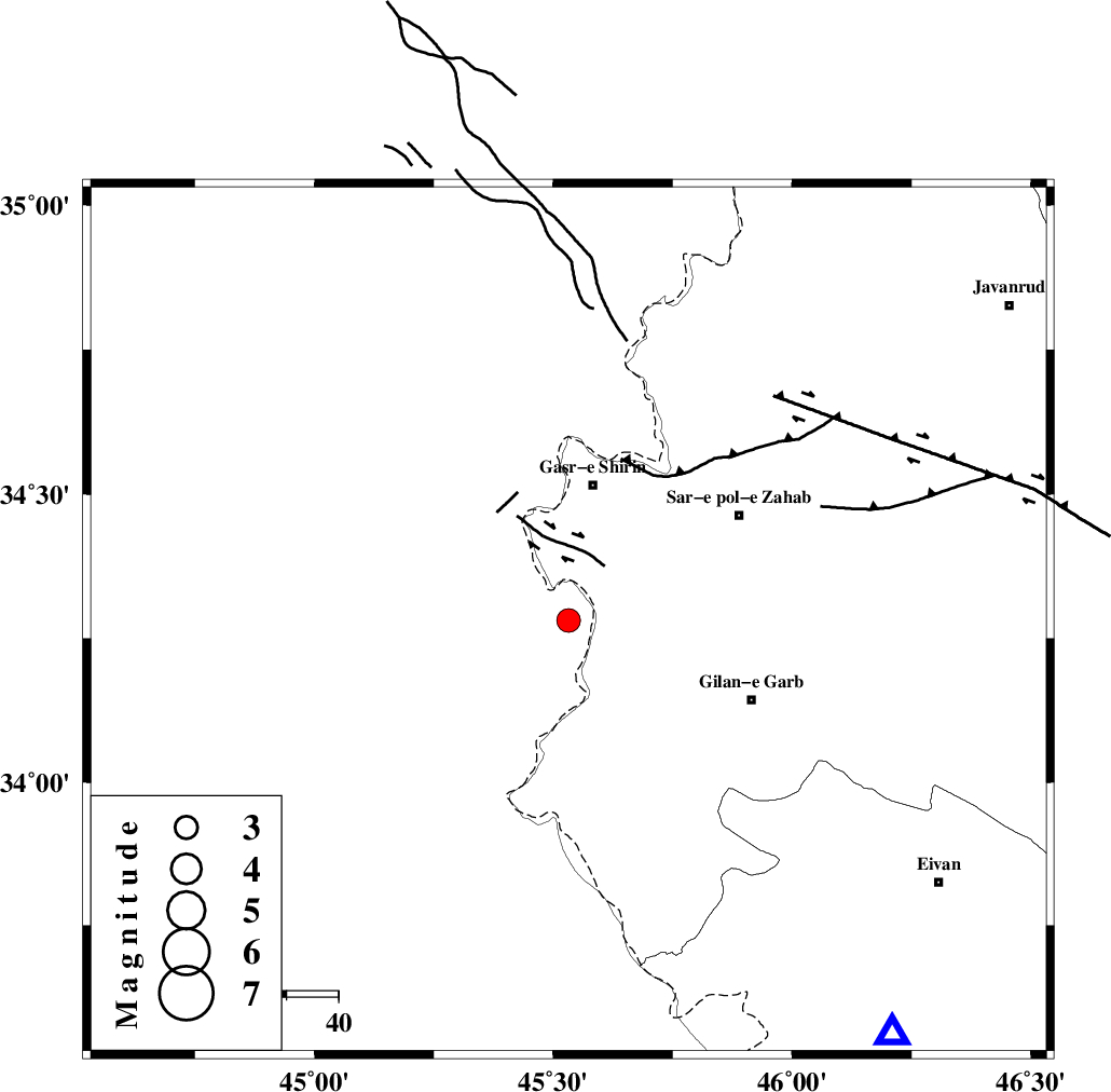
| Location | Lat:34.281 Lon: 45.532 |
| Region | Iraq, 27 km South of Qasr-E-Shirin |
Nearest Cities |
|
| 14 km South of Khosravi, Kermanshah Province | |
| 19 km South of Seyyed sohrab, Kermanshah Province | |
| 27 km South of Qasr-E-Shirin, Kermanshah Province | |
| 30 km West of Chub baghan, Kermanshah Province | |
| 32 km South West of Aqabarar, Kermanshah Province | |
| Depth | 14 km |
| Agency | |
Faults within 150 km: |
|
| MFF8 (Length: 48 km) , Distance to epicenter: 39 km | |
| ZFF4 (Length: 128 km) , Distance to epicenter: 39 km | |
| MFF7 (Length: 99 km) , Distance to epicenter: 51 km | |
| Number of Phases | 6 |
| RMS | 0.1 |
| Number of Stations | 5 |
| Error in Latitude | >2.5 km |
| Error in Longitude | 5.7 km |
| Error in Depth | 4 km |
Download waveform in seisan format
to download seisan software Click here
to access information about IIEES stations Click here
Amplitude | ||||||||
| UID | Agency | Station | Component | Amplitude | Period | Arrival Time | Proccessing Time | Signal Clip |
| 113543 | IIEES | ILBA | E | 612.9 | 0.24 | 2017-02-24 00:38:08 | 2017-02-25 06:09:00 | n |
| 113544 | IIEES | SNGE | N | 190.6 | 0.44 | 2017-02-24 00:38:34 | 2017-02-25 06:09:00 | n |
| 113545 | IIEES | ASAO | E | 18 | 0.68 | 2017-02-24 00:39:49 | 2017-02-25 06:09:00 | n |
| 113546 | IIEES | GHVR | E | 10.4 | 0.75 | 2017-02-24 00:40:11 | 2017-02-25 06:09:00 | n |
| 113547 | IIEES | GHVR | N | 11.3 | 0.6 | 2017-02-24 00:40:22 | 2017-02-25 06:09:00 | n |
Phase | ||||||||||||
| Agency | Station | Component | Phase Type | Phase Quality | First Motion | Observed Arrival Time | Time Residual | Loc. Flag | Input Weight | Distance | Azimuth | |
| IIEES | ILBA | Z | Pg | E | 2017-02-24 00:37:53 | -0.01 | y | 95.9 | 139 | |||
| IIEES | SNGE | Z | Pg | E | 2017-02-24 00:38:07 | -0.05 | y | 189 | 61 | |||
| IIEES | SNGE | N | Sg | E | 2017-02-24 00:38:30 | 0.02 | y | 189 | 61 | |||
| IIEES | ZNJK | Z | Pn | E | 2017-02-24 00:38:33 | -0.04 | y | 390 | 46 | |||
| IIEES | ASAO | Z | Pn | E | 2017-02-24 00:38:36 | 0.17 | y | 414 | 85 | |||
| IIEES | GHVR | Z | Pn | E | 2017-02-24 00:38:49 | -0.09 | y | 526 | 86 | |||