
Magnitude |
:2.2 |
| Date & Time (UTC) | 2016-12-08 08:42:53.6 |
| Date & Time (Local) | 1395/9/18 12:12:53.6 |
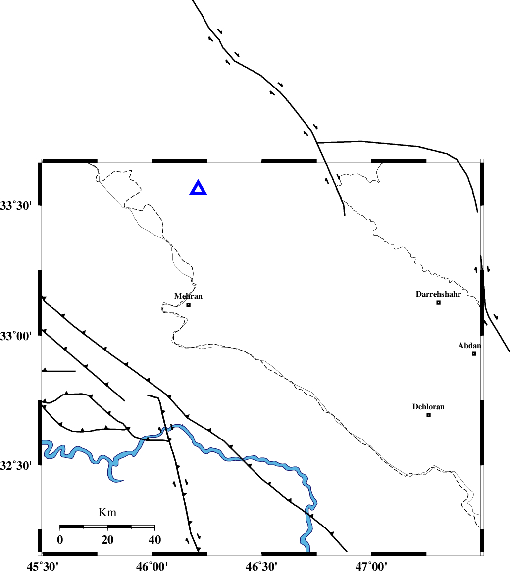
| Location | Lat:32.913 Lon: 46.496 |
| Region | Ilam Province, 38 km South-East of Mehran |
Nearest Cities |
|
| 38 km South of Gonbad-e pirmohammad, Ilam Province | |
| 38 km South East of Mehran, Ilam Province | |
| 46 km North West of Bishehzar, Ilam Province | |
| 47 km South of Galeh-yedarre-hemalakshahi, Ilam Province | |
| 54 km South West of Meymeh, Ilam Province | |
| Depth | 16 km |
| Agency | |
Faults within 150 km: |
|
| MFF6 (Length: 144 km) , Distance to epicenter: 18 km | |
| ZFF4 (Length: 128 km) , Distance to epicenter: 27 km | |
| MFF7 (Length: 99 km) , Distance to epicenter: 41 km | |
| Number of Phases | 4 |
| RMS | 0 |
| Number of Stations | 3 |
| Error in Latitude | >8 km |
| Error in Longitude | 9.1 km |
| Error in Depth | 9.5 km |
Download waveform in seisan format
to download seisan software Click here
to access information about IIEES stations Click here
Amplitude | ||||||||
| UID | Agency | Station | Component | Amplitude | Period | Arrival Time | Proccessing Time | Signal Clip |
| 111267 | IIEES | ILBA | E | 59.7 | 0.43 | 2016-12-08 08:43:24 | 2016-12-10 10:16:00 | n |
| 111268 | IIEES | ILBA | N | 94.8 | 0.43 | 2016-12-08 08:43:30 | 2016-12-10 10:16:00 | n |
| 111269 | IIEES | SNGE | E | 11.8 | 0.44 | 2016-12-08 08:44:13 | 2016-12-10 10:16:00 | n |
| 111270 | IIEES | SNGE | N | 9.3 | 0.65 | 2016-12-08 08:44:16 | 2016-12-10 10:16:00 | n |
| 111271 | IIEES | ASAO | N | 5.8 | 0.78 | 2016-12-08 08:44:51 | 2016-12-10 10:16:00 | n |
Phase | ||||||||||||
| Agency | Station | Component | Phase Type | Phase Quality | First Motion | Observed Arrival Time | Time Residual | Loc. Flag | Input Weight | Distance | Azimuth | |
| IIEES | ILBA | Z | Pg | E | 2016-12-08 08:43:07 | 0 | y | 83.3 | 341 | |||
| IIEES | SNGE | Z | Pn | E | 2016-12-08 08:43:32 | 0 | y | 254 | 18 | |||
| IIEES | ASAO | Z | Pn | E | 2016-12-08 08:43:47 | 0 | y | 374 | 60 | |||
| IIEES | ASAO | N | S | E | 2016-12-08 08:44:27 | 0 | y | 374 | 60 | |||