
Magnitude |
:2.9 |
| Date & Time (UTC) | 2016-02-18 00:28:02.3 |
| Date & Time (Local) | 1394/11/29 03:58:02.3 |
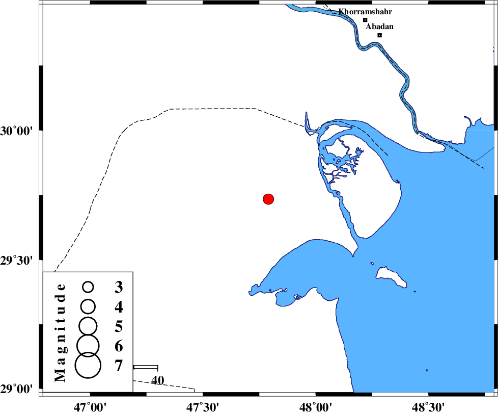
| Location | Lat:29.735 Lon: 47.79 |
| Region | Kuwait, 45 km North-West of Kuwait |
Nearest Cities |
|
| 45 km North West of Kuwait, Kuwait Province | |
| 84 km South West of Farrokhzad, Khoozestan Province | |
| 85 km South West of Abadan, Khoozestan Province | |
| 87 km South West of Khorramshahr, Khoozestan Province | |
| 87 km South of Al Basrah, Iraq Province | |
| Depth | 15 km |
| Agency | |
Faults within 150 km: |
|
| Number of Phases | 7 |
| RMS | 0.2 |
| Number of Stations | 7 |
| Error in Latitude | >4.8 km |
| Error in Longitude | 2.3 km |
| Error in Depth | 0 km |
Download waveform in seisan format
to download seisan software Click here
to access information about IIEES stations Click here
Amplitude | ||||||||
| UID | Agency | Station | Component | Amplitude | Period | Arrival Time | Proccessing Time | Signal Clip |
| 104489 | IIEES | AHRM | E | 17.8 | 0.38 | 2016-02-18 00:29:50 | 2016-02-20 11:30:00 | n |
| 104490 | IIEES | AHRM | N | 21.5 | 0.38 | 2016-02-18 00:29:59 | 2016-02-20 11:30:00 | n |
| 104491 | IIEES | GHIR | E | 5.1 | 0.32 | 2016-02-18 00:30:12 | 2016-02-20 11:30:00 | n |
| 104492 | IIEES | GHIR | N | 5.5 | 0.45 | 2016-02-18 00:30:13 | 2016-02-20 11:30:00 | n |
| 104493 | IIEES | ASAO | E | 4.6 | 0.66 | 2016-02-18 00:30:30 | 2016-02-20 11:30:00 | n |
| 104494 | IIEES | ASAO | N | 4.2 | 0.44 | 2016-02-18 00:30:30 | 2016-02-20 11:30:00 | n |
| 104495 | IIEES | NASN | N | 3.3 | 0.19 | 2016-02-18 00:30:25 | 2016-02-20 11:30:00 | n |
| 104496 | IIEES | SNGE | N | 8.8 | 0.54 | 2016-02-18 00:30:28 | 2016-02-20 11:30:00 | n |
Phase | ||||||||||||
| Agency | Station | Component | Phase Type | Phase Quality | First Motion | Observed Arrival Time | Time Residual | Loc. Flag | Input Weight | Distance | Azimuth | |
| IIEES | AHRM | Z | Pn | E | 2016-02-18 00:28:53 | 0.08 | y | 354 | 105 | |||
| IIEES | KHMZ | Z | Pn | E | 2016-02-18 00:29:11 | 0.11 | y | 489 | 24 | |||
| IIEES | GHIR | Z | Pn | E | 2016-02-18 00:29:15 | -0.03 | y | 531 | 106 | |||
| IIEES | ASAO | Z | Pn | E | 2016-02-18 00:29:21 | 0.1 | y | 574 | 21 | |||
| IIEES | NASN | Z | Pn | E | 2016-02-18 00:29:23 | 0.11 | y | 586 | 53 | |||
| IIEES | SNGE | Z | Pn | E | 2016-02-18 00:29:23 | -0.14 | y | 596 | 356 | |||
| IIEES | YZKH | Z | Pn | E | 2016-02-18 00:29:38 | -0.4 | y | 713 | 64 | |||