
Magnitude |
:2.7 |
| Date & Time (UTC) | 2015-10-14 13:51:07.8 |
| Date & Time (Local) | 1394/7/22 17:21:07.8 |
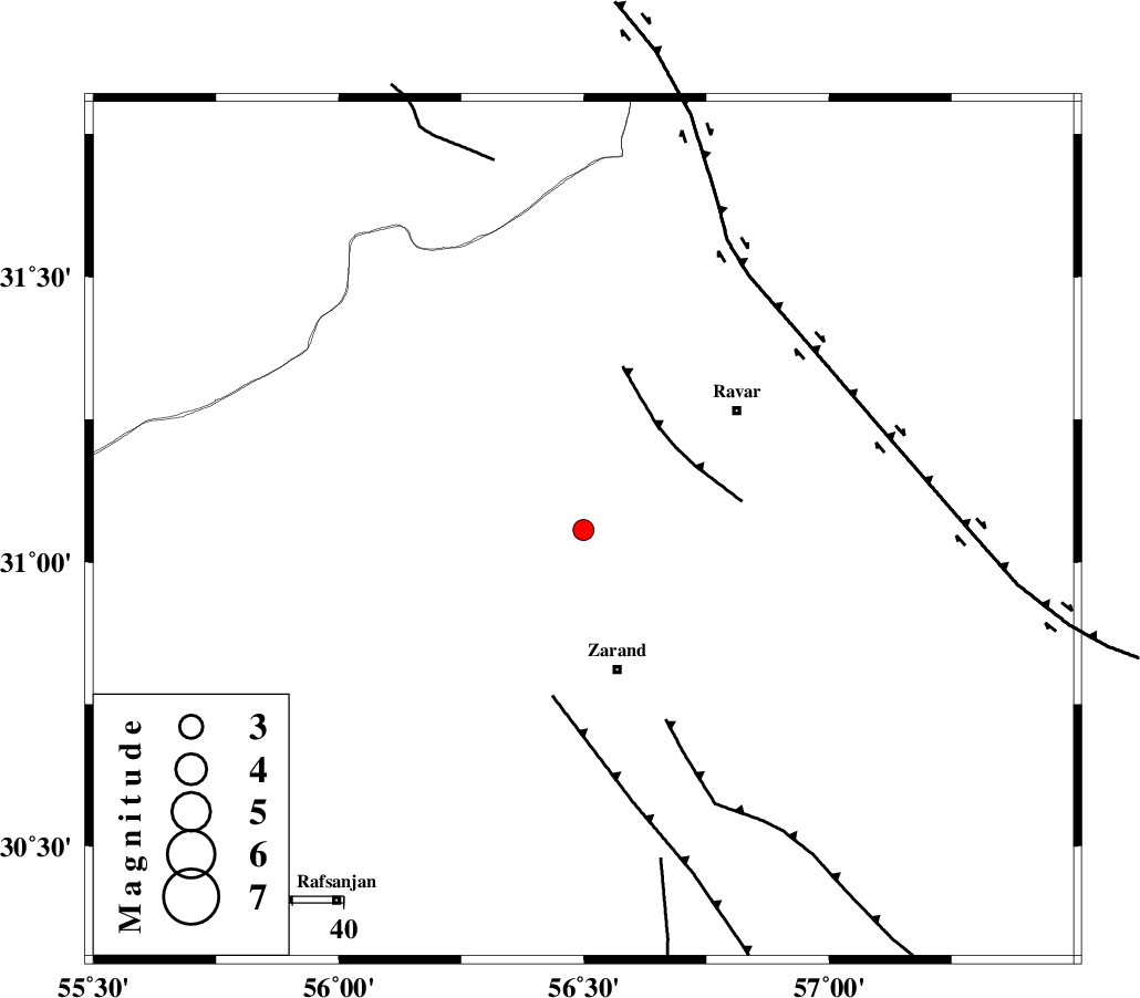
| Location | Lat:31.056 Lon: 56.499 |
| Region | Kerman Province, 28 km North of Zarand |
Nearest Cities |
|
| 6 km of Dasht-e khak, Kerman Province | |
| 13 km of Toghroljerd, Kerman Province | |
| 13 km North West of Ahmadi, Kerman Province | |
| 28 km North of Zarand, Kerman Province | |
| 31 km North of Mohammadabad, Kerman Province | |
| Depth | 14 km |
| Agency | |
Faults within 150 km: |
|
| KUHBANAN_F (Length: 189 km) , Distance to epicenter: 6 km | |
| DARIVAN_F (Length: 131 km) , Distance to epicenter: 49 km | |
| LAKARKUH_F (Length: 138 km) , Distance to epicenter: 62 km | |
| Number of Phases | 5 |
| RMS | 0.1 |
| Number of Stations | 3 |
| Error in Latitude | >2.2 km |
| Error in Longitude | 3.3 km |
| Error in Depth | 5.7 km |
Download waveform in seisan format
to download seisan software Click here
to access information about IIEES stations Click here
Amplitude | ||||||||
| UID | Agency | Station | Component | Amplitude | Period | Arrival Time | Proccessing Time | Signal Clip |
| 101777 | IIEES | KRBR | E | 160.4 | 0.41 | 2015-10-14 13:51:47 | 2015-10-17 10:47:00 | n |
| 101778 | IIEES | KRBR | N | 149.8 | 0.29 | 2015-10-14 13:51:49 | 2015-10-17 10:47:00 | n |
Phase | ||||||||||||
| Agency | Station | Component | Phase Type | Phase Quality | First Motion | Observed Arrival Time | Time Residual | Loc. Flag | Input Weight | Distance | Azimuth | |
| IIEES | KRBR | Z | Pg | E | 2015-10-14 13:51:28 | 0.01 | y | 122 | 168 | |||
| IIEES | KRBR | N | Sg | E | 2015-10-14 13:51:43 | -0.03 | y | 122 | 168 | |||
| IIEES | YZKH | Z | Pn | E | 2015-10-14 13:51:44 | 0.17 | y | 234 | 310 | |||
| IIEES | YZKH | N | Sg | E | 2015-10-14 13:52:14 | -0.11 | y | 234 | 310 | |||
| IIEES | BSRN | Z | Pn | E | 2015-10-14 13:51:48 | -0.04 | y | 269 | 67 | |||