
Magnitude |
:3.2 |
| Date & Time (UTC) | 2015-10-03 17:55:17.2 |
| Date & Time (Local) | 1394/7/11 21:25:17.2 |
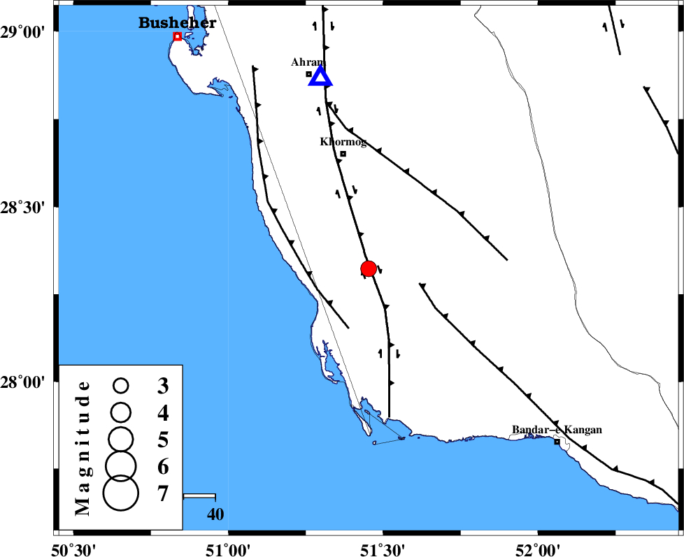
| Location | Lat:28.323 Lon: 51.453 |
| Region | Bushehr Province, 37 km South of Khormog |
Nearest Cities |
|
| 6 km of Kaki, Bushehr Province | |
| 9 km of Baduleh, Bushehr Province | |
| 19 km North of Abkesh, Bushehr Province | |
| 19 km North of Ziyarat, Bushehr Province | |
| 30 km North of Bardkhun, Bushehr Province | |
| Depth | 8 km |
| Agency | |
Faults within 150 km: |
|
| BORAZJAN_F (Length: 168 km) , Distance to epicenter: 4 km | |
| MFF3 (Length: 292 km) , Distance to epicenter: 17 km | |
| ZFF2 (Length: 84 km) , Distance to epicenter: 17 km | |
| Number of Phases | 4 |
| RMS | 0 |
| Number of Stations | 3 |
| Error in Latitude | >4.7 km |
| Error in Longitude | 8.7 km |
| Error in Depth | 6 km |
Download waveform in seisan format
to download seisan software Click here
to access information about IIEES stations Click here
Amplitude | ||||||||
| UID | Agency | Station | Component | Amplitude | Period | Arrival Time | Proccessing Time | Signal Clip |
| 101387 | IIEES | AHRM | E | 1520.2 | 0.33 | 2015-10-03 17:55:42 | 2015-10-04 06:26:00 | n |
Phase | ||||||||||||
| Agency | Station | Component | Phase Type | Phase Quality | First Motion | Observed Arrival Time | Time Residual | Loc. Flag | Input Weight | Distance | Azimuth | |
| IIEES | AHRM | Z | Pg | E | 2015-10-03 17:55:28 | 0 | y | 62 | 346 | |||
| IIEES | AHRM | N | Sg | E | 2015-10-03 17:55:36 | 0 | y | 62 | 346 | |||
| IIEES | YZKH | Z | Pn | E | 2015-10-03 17:56:33 | 0 | y | 542 | 33 | |||
| IIEES | ASAO | Z | Pn | E | 2015-10-03 17:56:53 | 0 | y | 703 | 349 | |||