
Magnitude |
:2.4 |
| Date & Time (UTC) | 2015-08-29 04:25:26.0 |
| Date & Time (Local) | 1394/6/7 08:55:26.0 |
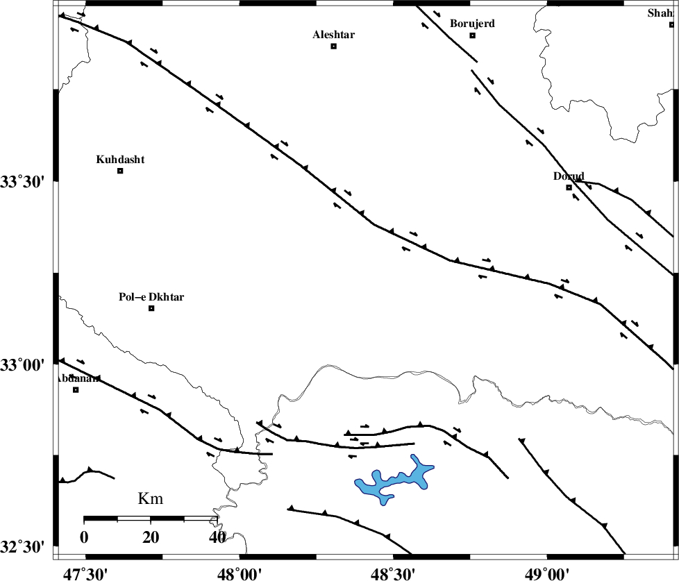
| Location | Lat:33.227 Lon: 48.411 |
| Region | Lorestan Province, 29 km South of Khorramabad |
Nearest Cities |
|
| 19 km South of Daraei, Lorestan Province | |
| 25 km South of Kamalvand-e gholamali, Lorestan Province | |
| 26 km South of Badrabad-e sofla, Lorestan Province | |
| 26 km South West of Emanabad, Lorestan Province | |
| 27 km South East of Shoorab-e sofla, Lorestan Province | |
| Depth | 14 km |
| Agency | |
Faults within 150 km: |
|
| HZF4 (Length: 492 km) , Distance to epicenter: 17 km | |
| BALARUD_F_Z2 (Length: 58 km) , Distance to epicenter: 46 km | |
| BALARUD_F_Z3 (Length: 53 km) , Distance to epicenter: 51 km | |
| Number of Phases | 5 |
| RMS | 0.1 |
| Number of Stations | 3 |
| Error in Latitude | >4 km |
| Error in Longitude | 2.6 km |
| Error in Depth | 5.5 km |
Download waveform in seisan format
to download seisan software Click here
to access information about IIEES stations Click here
Amplitude | ||||||||
| UID | Agency | Station | Component | Amplitude | Period | Arrival Time | Proccessing Time | Signal Clip |
| 100528 | IIEES | SNGE | N | 26.7 | 0.64 | 2015-08-29 04:26:35 | 2015-08-29 06:28:00 | n |
Phase | ||||||||||||
| Agency | Station | Component | Phase Type | Phase Quality | First Motion | Observed Arrival Time | Time Residual | Loc. Flag | Input Weight | Distance | Azimuth | |
| IIEES | KHMZ | Z | Pg | E | 2015-08-29 04:25:51 | -0.09 | y | 155 | 68 | |||
| IIEES | ASAO | Z | Pn | E | 2015-08-29 04:26:00 | 0.23 | y | 209 | 45 | |||
| IIEES | ASAO | N | Sg | E | 2015-08-29 04:26:25 | -0.05 | y | 209 | 45 | |||
| IIEES | SNGE | Z | Pn | E | 2015-08-29 04:26:02 | -0.14 | y | 229 | 335 | |||
| IIEES | SNGE | N | Sg | E | 2015-08-29 04:26:31 | 0.04 | y | 229 | 335 | |||