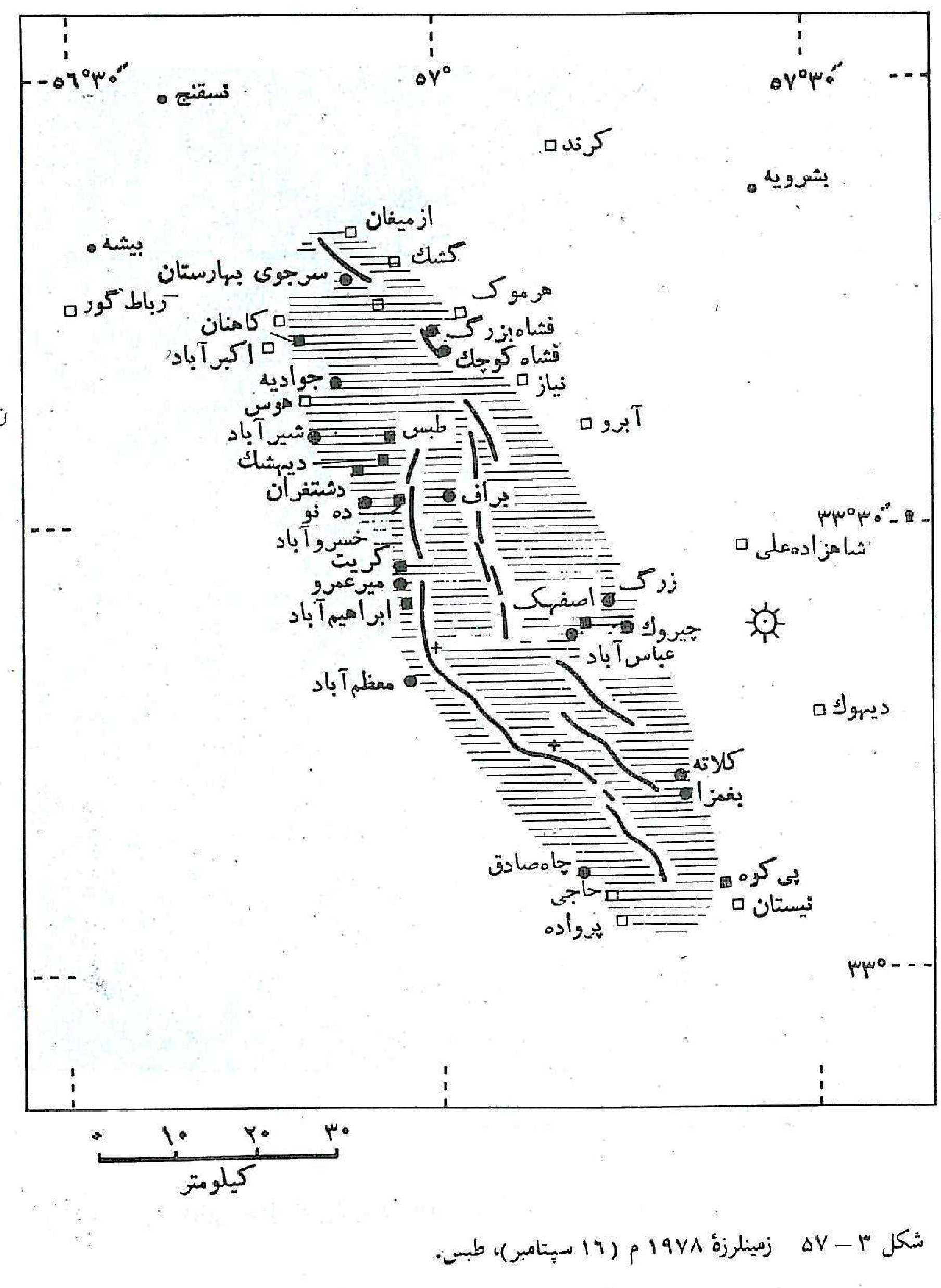
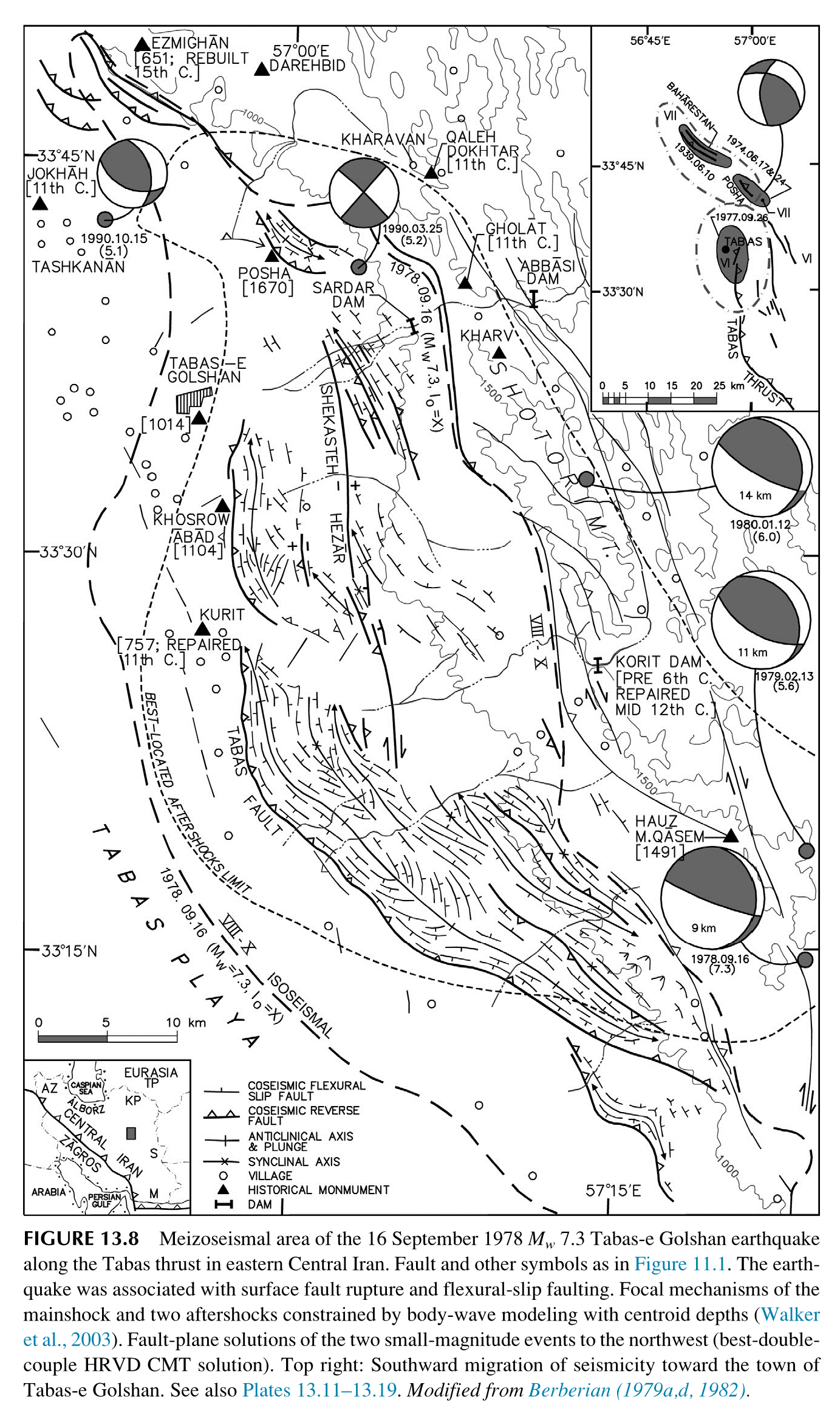
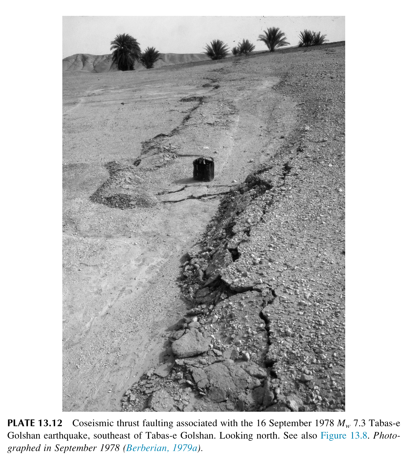
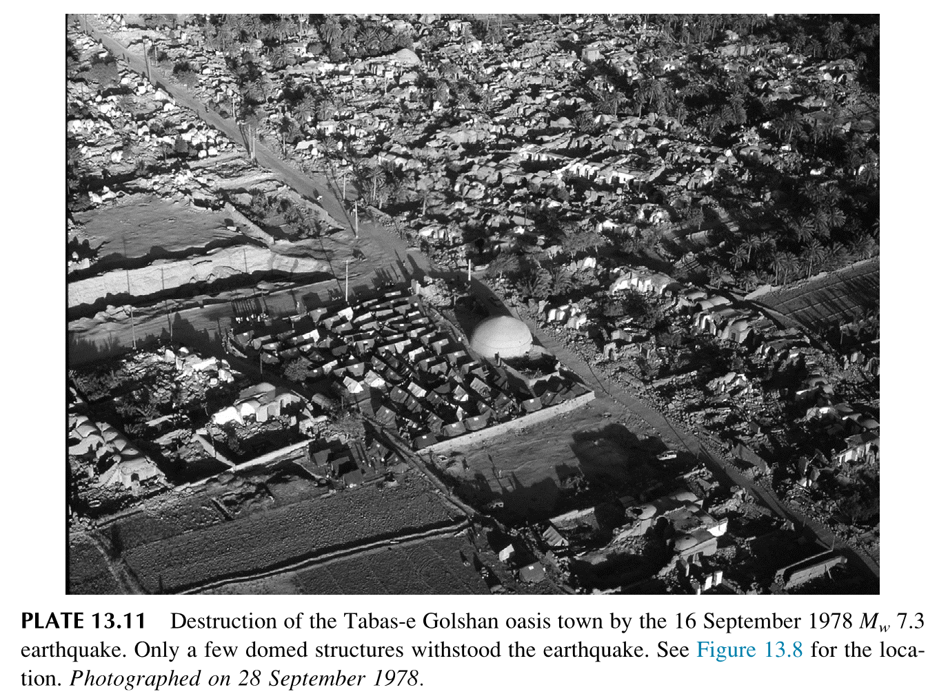
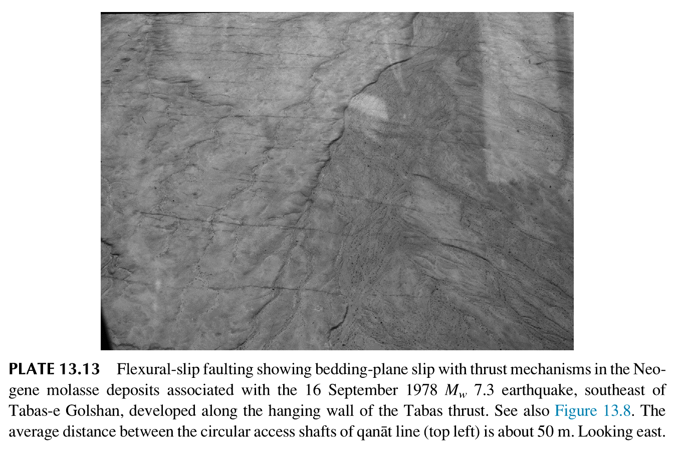
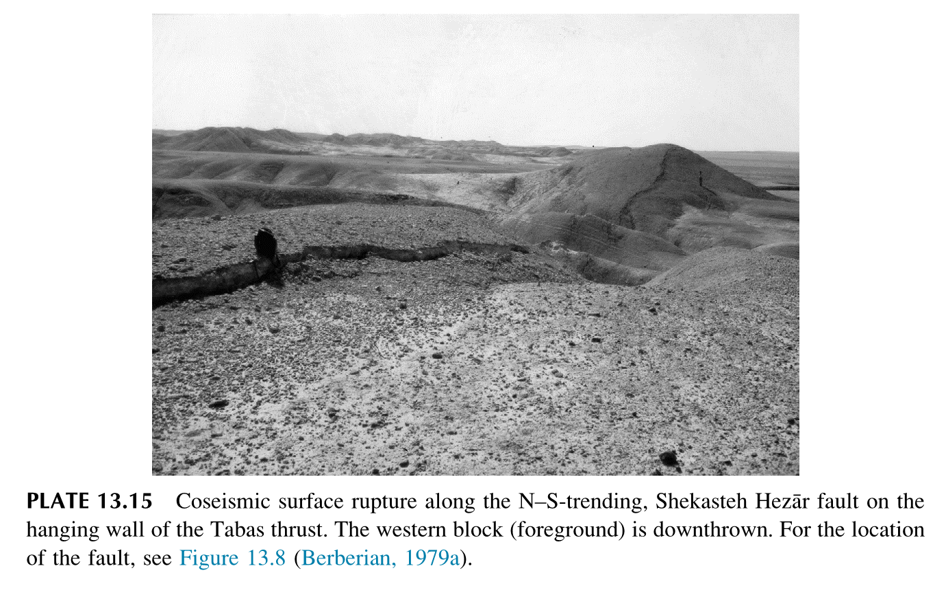
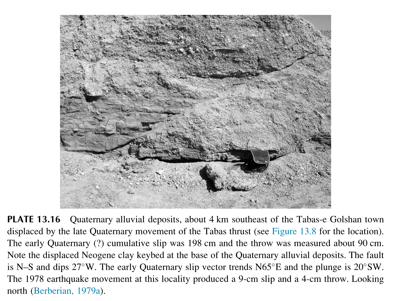
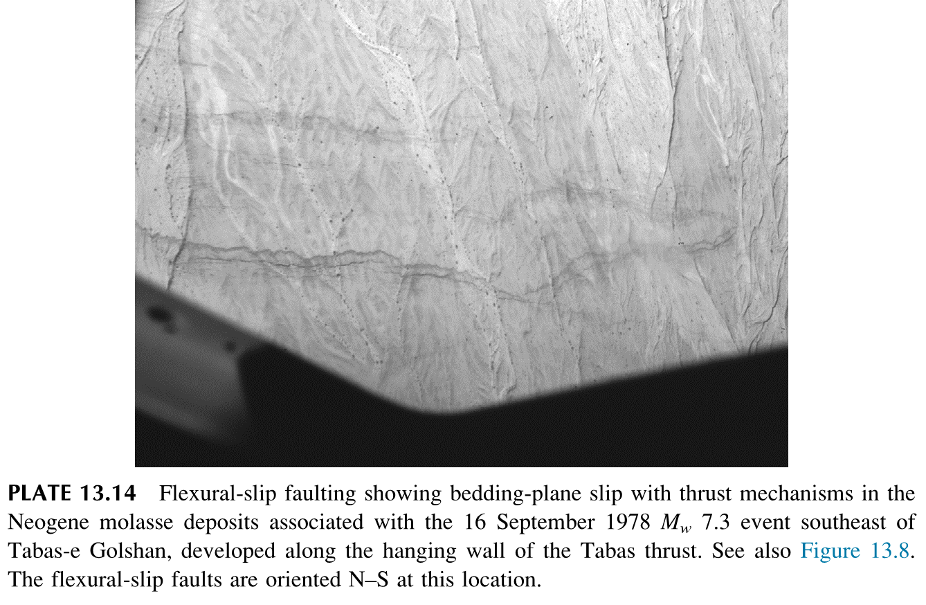
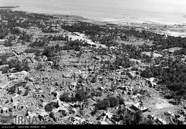
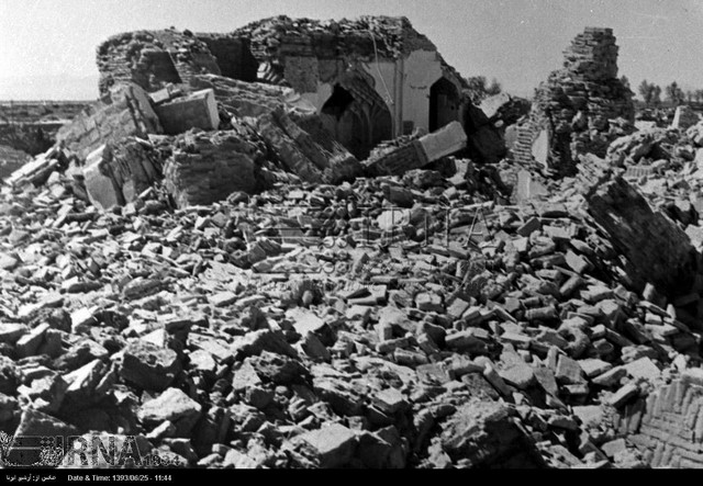
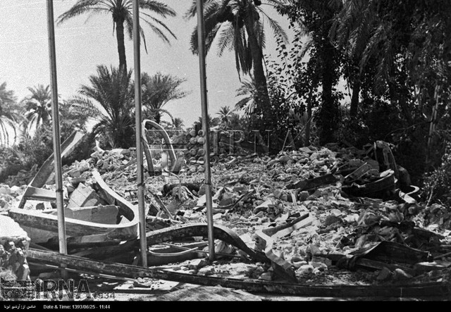
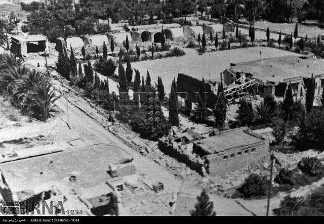
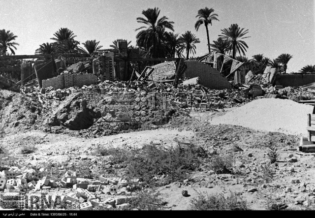
Tabas Earthquake of 16 September 1978, Mw=7.4
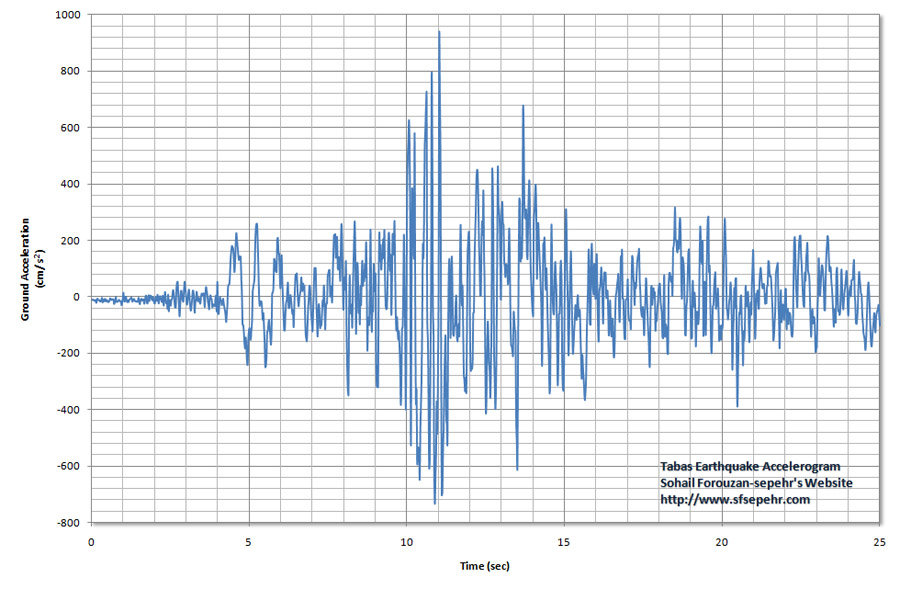
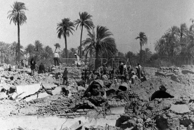
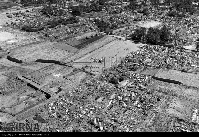
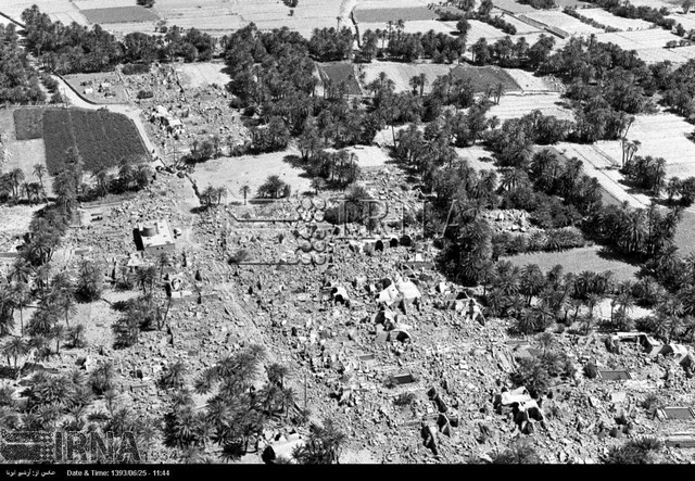
Ten years after the 1968 Dasht-e Bayaz/Ferdows earthquakes, the seismicity seems to have migrated cross fault from the Ferdows thrust in the northeast to the Tabas thrust fault in the southwest. The 1978 earthquake with Magnitude of Mw=7.4 killed more than 15,000 people, destroyed or severely damaged about 90 villages, partially damaged another 50 villages in the region, and completely demolished the evergreen oasis town of Tabas-e Golshan, where 85% of the inhabitants (11,000 out of 13,000) were killed. The earthquake ruptured the unmapped and unknown Tabas thrust fault at the western Neogene foothills of the Shotori Mountains. Evidence of active faulting is preserved in the landscape in the form of truncated asymmetric anticlinal folding in the Neogene molase deposits, deformation of the late Quaternary alluvial fan deposits, and widespread river incision. The Tabas-e Golshan earthquake was associated with (i) 75-km long, coseismic surface thrust faulting dipping east–northeast along a curved fault line and (ii) flexural-slip faulting in the form of bedding-plane slip with a thrust mechanism on the hanging wall of the Tabas thrust in a vast area. About 75 km of discontinuous coseismic thrust faulting, in several segments of arcuate form, was mapped at the surface along an existing but unrecognized foothill-front reverse fault, the Tabas active thrust. The highest-quality, locally recorded aftershock hypocenters occurred mainly at a depth less than 23 km with a high concentration of seismic activity between 8 and 14 km. The best-located aftershocks with their well-constrained focal mechanisms demonstrated an active imbricate listric thrust system (covering both the hanging wall as well as the footwall blocks) with fault planes flattening into a possible basement decollement zone. Analyses of strong motion records indicated that the rupture propagation was mostly unilateral from the southeast to the northwest at an average rupture velocity of 2.5 km/s. The majority of the slip, in at least four subevents, contributing to the strong-motion signals and the WWSSN body waves, terminated about 15 km NW of Tabas-e Golshan, giving a fault length of 90 km. Maximum coseismic surface faulting of about 75 km was observed and mapped on the surface. As with the teleseismic location, the relocated epicenter of the 1978 Tabas-e Golshan mainshock is placed close to the southern end of the coseismic surface ruptures, indicating a possible unilateral northward rupture propagation. Analysis of strong-motion records indicates the presence of at least four, and probably more, discrete subevents in the mainshock, but their locations could not be constrained. Since the maximum measured “single” thrust displacement at the surface was only 35 cm, the major part of the primary rupture is likely to have been blind. Aftershock locations from the deployment of nine local seismometers showed that (i) most of the aftershocks were located in the hangingwall of the Tabas thrust; (ii) the seismicity flattened with depth toward east northeast; (iii) aftershocks concentrated in depth about 10 km; (iv) scattered seismicity located in the Tabas playa (on the footwall) indicating fault activity to the west of the surface rupture as well; and (v) very little activity was detected beneath the Shotori Mountains to the east, where the range-front fault did not show any surface activity (Berberian, 2014).